canyonwalker: Hangin' in a hammock (life's a beach)
Italy Travelog #18
Chia, Sardinia - Wednesday, 28 May 2025, 10am

We've been in Sardinia for almost a day at this point. We've been taking it easy for the most part. Yesterday we had lunch with colleagues after arrival, then I crashed in our room for a few hours before the reception dinner. This morning we enjoyed a leisurely breakfast at the hotel then got ready for the day's outing— a cave tour. While we're en route to the cave I'm jotting down a few notes about Sardinia thus far.

Random view of the Sardinian coast (May 2025)

The first is that it's beautiful here, and rural. Sardinia has a population of about 1.6 million. That may seem like a lot; it'd be a fair sized city, if it were a city. But Sardinia is the second largest island in the Mediterranean. A size comparison shows it's about the size of Vermont. ...Well, Vermont has 6500,000 people, so Sardinia is less rural than Vermont. Perhaps a better comparison would be to Sicily, the largest Mediterranean island, which is only slightly larger than Sardinia and has 3x the population.

Part of what makes Sardinia feel so rural is that the coast is very wilderness-y. There are no towns along the rugged coastline, no multi-million-dollar mansions, no high-rise resort hotels. I've heard accounts from two people now, including a local archaeology Ph.D., that the "no towns" thing is because of the historic threats of invasion and piracy. Occupants of the island from hundreds of years ago to thousands of years ago built villages inland so they wouldn't be so exposed to marauders; whether the Romans, the Carthaginians, the Phoenicians, the Moors, or the Spanish.

Speaking of the Spanish, it's actually the Catalans who've had a strong influence here. Our tour guide (the aforementioned archaeology Ph.D.) mentioned that with a broad smile because two of our companions on our little group trek are Catalan, from Barcelona. For hundreds of years during the Middle Ages Catalans ruled the island. There are still communities of Catalans on the island today, though they are in the north and we're traveling around the far south.

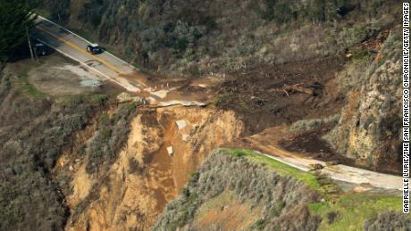
One other thing that strikes me as we're driving around these remote parts of the coast in Sardinia is that it looks and feels a lot like California. Except for the road signs being in Italian I could almost swear I'm on the central coast. It's the rugged coast, the mountains near the water, and the types of trees and shrubs all around us. Climate-wise, it's a similar climate.
canyonwalker: My old '98 M3 convertible (road trip!)
Today we headed out to the Pinnacles— Pinnacles National Park— to hike. It's a day-adventure I've been looking forward to for a while, and finally today our schedules and the weather aligned. And oh, what nice weather it was. The park had a high temperature of 78° today, warm enough to feel, well, warm but not so hot that we'd regret being out in the sun. I mean, in the summer it gets really smokin' out there, like 100+. Thus a clear day in early spring is really the perfect time to visit. Like today!

We got off to a late start today. It wasn't until around 9:30 that we left the house. I'm not too proud to admit that I had some cold feet this morning about the hike, after planning it for the past week. The problem was I slept poorly last night. I considered whether I wanted to take an "easy day" today. I'd still go hiking somewhere; but somewhere shorter and easier. Intellectually I knew that I'd be happy once I got to the Pinnacles, but it took some pushing to get through the blahs.

The drive down to the Pinnacles was enjoyable. At 9:30am on Easter Sunday there wasn't a crazy amount of traffic. I mean, all 4 lanes in both directions on US-101 through San Jose were busy, just not bumper-to-bumper at 60mph like it sometimes gets.

42 miles out from home we reach the town of Gilroy. This is the southern end of what anyone could reasonably call the Bay Area or metropolitan San Jose. Though people do commute in from farther out than this. 😳 Beyond Gilroy US 101 narrows to 2 lanes in each direction and becomes a bit of a country highway as it traverses, well, countryside into Central California.

At 48 miles we reach the San Benito County line. Yes, 48 miles and we've just left the county. Where I grew up on the East Coast I could drive 48 miles and it'd involve 3 states. Welcome to the Western US! Government boundaries aside, we're happy to note as we cross the county line that the mountains around us are all still green.

At around 60 miles we near Prunedale. The only nice thing I have to say about Prunedale is that they finally allowed Caltrans to widen and straighten US-101 through their community so it's no longer a traffic bottleneck. Now it's a pleasure driving through the short mountain range here and dropping into the Salinas Valley on the other side.

At 67 miles we roll into the north side of Salinas. We're hungry so we stop for brunch at a couple of fast food restaurants. I eat at Carl's Jr.; Hawk gets Sonic Drive-In across the street. Then we get donuts for dessert from a nearby shop.

While in Salinas I have a... wardrobe malfunction. A seam ripped in my hiking shorts. I briefly consider a) just hiking for the day with a hole in my pants or b) just going home because I'm so pissed about it. Hawk points out we're literally right in front of a Wal-Mart, and almost certainly they have something inside I can buy and wear. I grumble about Wal-Mart fashion before, to my surprise, I find not one but three items of clothes to buy there!

South of Salinas 101 is a chill road. It's straight and level as it traverses farmland in the agricultural Salinas Valley. There's a Steinbeck museum here. He was born in Salinas and used it as inspiration for many of the settings in his books, including it being featuring literally in his classic, The Grapes of Wrath. I've read Salinas people are so pleased about it they've held book burnings in his honor.

At 97 miles we're finally in Soledad. This small town is where we turn off the highway and head up into the rugged hills of the Gabilan Mountains. You probably haven't heard of the Gabilan Mountains. But one thing interesting about them is they're so remote they're crossed than fewer roads than the Sierra Nevada range with its 14,000' peaks. And even state highway 146, which leads to the park, doesn't cross these mountains. It stops halfway across. It stops halfway across, in the park, then picks up again on the other side! The only way across Pinnacles National Park is on foot. That's how you know you're in a hard-core hiking park.

canyonwalker: Planes, Trains, and Automobiles. Travel! (planes trains and automobiles)
What comes after Friday Night Halfway? Saturday the Rest of the Way! After driving to Fresno on Friday night we'd drive the rest of the way up into the Sierra Nevadas on Saturday morning, do two planned hikes, and drive all the way home that night.

Saturday morning began just before our 6:30am alarms. We'd set them early to allow ourselves the chance to maximize the day. I awoke, refreshed, a few minutes before my alarm and got out of bed to begin my morning routine. That was surprising because all this past week I've struggled with my 6:45am workday alarm, often only scraping myself out of bed at 7:30 and still feeling groggy. All I can figure is I went to bed just after 10 Friday night so I'd gotten a solid 8 hours. This past week I've been staying up past 11pm or even past midnight working on my new D&D game.

Being up early meant seeing the sun rise. The sky was already beginning to get light around 6:30. A few minutes before 7am I watched the sun break over the Sierra Nevada mountains to the east. It was touching that as I prepared to face the day, the day prepared to face me.

We packed our bags and got ready for the day in no particular rush. We set our alarms at 6:30 not so that we could be rolling by 7am but so that we could take it easy and still be out by 8. But then we made three stops almost right away: two for food, and one for gas. There was a Costco 1/2 mile from our hotel for cheap gas!

Clovis, California,

Our route for the morning was simple in concept: Get on highway 168 and drive 61 miles to the dirt access road to the falls. As we drove through the town of Clovis before getting back on the highway we passed through the charming downtown area— all 4 blocks of it. 😅 Suspended over the street is a green sign, "Clovis Gateway to the Sierras". Well, that's accurate for us. Clovis was our Friday Night Halfway and thus our gateway to the Sierras today.

The drive up into the Sierras was pleasant. ...Well, once we got into the Sierras it was pleasant. The drive through the Central Valley and the western foothills was miles of brown grass beneath an alarmingly smoggy sky. Once we started climbing into the mountains— passing roadside markers for 2,000'... 3,000'... 4,000'... 5,000' and beyond— the sky became clearer blue. By the time we reached Shaver Lake at elev. 5500 or so we could look back down on the massive Central Valley below us and see... a bowl of cloudy brown soup, basically. 😳🤢😷

Shaver Lake wasn't the end of the drive. No, we continued on over the Tamarack Ridge at elev. 7,582' and then down toward Huntington Lake beyond it. From near Huntington it was back up, up, up on the dirt road to the falls. At the trailhead we were at elev. 7,585'.

Rancheria Falls trailhead, Sierra National Forest (Aug 2023)

Time to hike!

Update: pictures from Rancheria Falls!

canyonwalker: My old '98 M3 convertible (cars)
What comes after Friday Night Halfway? Would you believe Saturday Night Halfway? After driving to Folsom last night, halfway to Bassi Falls today (okay, it was mathematically more than halfway), this afternoon we drove from near Bassi Falls to Madera, California.

"What's Madera halfway to?" might be one of your questions.
"And where even is Madera?" might be your other.


To answer the second one first, Madera is in California's Central Valley, a bit north of Fresno. In fact Madera, with a population of almost 70,000, is now considered part of the Fresno metropolitan area, which has a regional population of 1.4 million. Fresno proper has almost 600,000 residents, making it the 5th largest city in California. It's behind San Francisco, which is only the 4th largest city in the state!

Our plan for tomorrow is to drive up into the Sierra Nevada, through the town of Oakhurst, to hike Lewis Creek. There are a number of falls there we've enjoyed visiting in the past.

Driving to Madera today was quite a haul. After we had an early dinner back in Folsom it was 3 hours of solid driving to Madera. That's on top of the driving— and hiking— earlier in the day. Driving-wise I logged almost 300 miles today. But we arrived at the Hampton Inn in Madera around 7:15pm with nothing else on the agenda for the rest of the evening except rest & relaxation. ...Well, that and a bit of food and a delicious milkshake from Sonic Drive-In a few minutes away.

canyonwalker: My other car is a pair of hiking boots (in beauty I walk)
It's been a busy Saturday. Hawk and I got up early today to go to the beach in Santa Cruz. We've been saying we'll do that for the past few weekends but it's never worked out. Either we say we'll get up early then sleep in 'til 9am or later, or the weather's looked too cold and cloudy over at the coast, or both. Today the weather forecast wasn't looking that amazing for Santa Cruz— while it was forecasting 88° and sunny here— but we decided to do it anyway.

Getting an early leave on for the beach was critical because traffic jams going over the mountains on Rt. 17 have been crazy the past many weeks. Last weekend traffic delays made a trip that would normally take about 45 minutes stretch to 2 hours. We noped out of that. Today we were rolling at 9am and even then traffic jams on Rt. 17 set us back 10-15 minutes. WTF is everyone going to the beach so early for? Especially on a day when the forecast there has it cold and foggy until noon?

Maybe, we figured, they're like us and want to beat the crowds. We worried that the hundreds of people driving with us on the mountain pass would be competing for scant parking in Santa Cruz near the beach... but alas, thankfully, they were not. Traffic all but disappeared by the time we got to our favorite parking spot on West Cliff Drive, with a rocky cliff 10' in front of us and the pounding waves 25' below that.

The fog was already burning off when we arrived. We started walking east from our parking spot, heading back toward downtown. We didn't walk that far, as it would have been several miles each way; just to the lighthouse and back. But still, that was a solid 3 miles round trip, maybe more.

After the walk we were ready for lunch. We found a hole-in-the-wall Mexican restaurant downtown. It was... definitely hole-in-the-wall. And crazy popular. Like, with not much seating and 2x-3x as many customers as could fit. Our timing was good and we got a table.

The drive back over the mountain was free of traffic. Seeing the lines of cars laboring up the opposite direction we joked about "reverse commute direction" several times. But seriously, I'm glad we weren't stuck in that mess, creeping along uphill, with temperatures that reached as high as 93° in some spots. (Back at the beach it topped out at, like, 70°.) Oh, did I mention we did the drive in our convertible? Man, tooling along through a mountain pass with fir trees on all sides, a blue sky overhead, and lots of fresh air is exactly what convertibles were built for. ...Okay, that plus the above except with mountains-and-ocean vistas... which we also got today! 😂

Back at home we had a couple of our friends come over with their 10 year old son today to use the pool. It was definitely pool weather out, with temps in town climbing past 85°. We splashed around in the pool for quite a while, took a short dip in the hot tub, then dried off while relaxing in deck chairs.

Our friends suggested dinner together around 5:30, but by then we were spent from the day's double-header. We bid them goodbye and spent a while relaxing quietly indoors. I made a simple dinner of mac and cheese and garlic bread. Now we're taking it easy again. Maybe we'll be rested up for another day outdoors tomorrow!

canyonwalker: My other car is a pair of hiking boots (in beauty I walk)
In my last blog about hiking at Pinnacles National Park this weekend I wrote about the signature experience - climbing the footholds blasted into the rock. It's one we enjoy on many of our trips there. This trip we found a new signature experience in addition to that.

One of the reasons the Pinnacles was upgraded from national monument status to the vaunted national park designation several years ago is that it's a habitat for the rare and endangered California Condor. Once near the brink of extinction, with only 27 individual birds surviving, all in captivity, there are now over 500 of the species alive, many reintroduced to the wild in California's Centra Coast region.

So, as you might have guessed, after all that climbing and crouching through tight spaces, we came out atop the High Peaks Loop and saw a California Condor sunning itself atop a large rock.

California Condor at Pinnacles National Park (Apr 2022)

Condors are huge birds. Adults can grow to about 4' (120cm) tall with wingspans of anywhere from 8-10' (2.5 - 3.0m). This bird, which I dub "Mateo" (can you guess why?), didn't seem quite that big. Mateo might be a juvenile.

Here's some video I shot of Mateo preening himself.


We've seen California Condors once or twice before in zoos. This was our first sighting in the wild. What a special way to cap a fun hike at The Pinnacles!


canyonwalker: My other car is a pair of hiking boots (in beauty I walk)
As we were driving to Pinnacles National Park and starting our hike to the High Peaks Loop I was thinking about our past visits there... which stretch back 25 years! Our first visit to the park was in April 1997. Back then it was Pinnacles National Monument, or just "The Pinnacles". (Its upgrade to National Park status came years later, in 2013.)

Cast your memory back to Friday, April 4, 1997. We were reading the weekend section in the Mercury News. They had a big front-page article— well, it was the front page of the D section, but it was big and had color pictures— and yes, it was on paper. We're talking some serious memory lane shit, here!

Anyway, on page D1 there was a big article about The Pinnacles, 2 hours south of us. We loved hiking then, as we do now, and we were ecstatic for the info about the park. We planned to go the very next day, Saturday.

That Saturday the park was crowded. It was so crowded we had to park in an overflow parking lot, which added extra distance to our hiking just to get to the trailhead. The trails were crowded, too. It was like walking at the mall. And I swear every second person had a copy of the dratted Mercury News tucked under their arm.

Hiking the High Peaks Loop at Pinnacles National Park (Apr 2022)

We're pros at the park now. We don't need newspapers tucked under our arms, or even their modern equivalent: blogs and maps on our smartphones. We know several of the routes by heart.

Just before I took the picture above we passed another pair of hikers at a junction. They were first-timers. We recommended which trails they should take to have the most memorable hike. It reminded me of when we were first-timers. I wish we'd gotten slightly better recommendations about what to hike first. BTW, in the picture above we're on the High Peaks Loop. In the distance is the Salinas Valley. In the far distance are the coast range mountains of Big Sur.

On our first visit we didn't make it up here, to the High Peak Loop. We started with a trail lower down, the Balconies Cave hike. That was what the author of the article recommended to start. Of course, the writer was a body nazi who could hike 14 miles a day over a mountain with one bottle of water and probably no shirt. We weren't in as good shape, and it was a hot day and there was extra hiking due to the overflow. We were spent just doing that hike. It was a good hike; just not the signature hike.

Stairs blasted into the rock at Pinnacles National Park (Apr 2022)

The signature hike at Pinnacles is the High Peak Loop. It's the standout trail not just because of the amazing, far-off views from the high peaks— of which there are plenty— but because of the tough parts of the trail, where you climb footholds blasted into the granite.

Usually when I want to remember where I hiked and when, I consult my pictures. Oddly my pictures from 1997, my analog pictures on 4"x6" prints, are inconclusive. Some of them look like the high peaks... but there definitely aren't any pics of these footholds blasted into the bare rock. I don't think we made it up here until probably our third visit, which I think may have been in Spring 1998.

Maneuvering through tight spaces at Pinnacles National Park (Apr 2022)

Plus, come on, once you've crouched over to climb through narrow spaces you remember it. At least I remember it. Especially when on the other side of that metal rail is a 1,200' drop to the valley below! That's where I'm practically certain we didn't make it up here until much later.

These tricky, stair-steppy parts of the trail aren't just one stretch but several, probably 4 or 5. This isn't a trail for the faint of heart! Though that said, it's also not a dangerous trail. The stairsteps in the rock make a huge difference. The metal rails do, too. It's just that they're both intimidating until you get used to how to use them.

Stairs blasted into the rock at Pinnacles National Park (Apr 2022)

By the time you get to the last rough stretch you might feel like a pro. Or you might feel like you've been put through the gauntlet. Or both!

And you'll probably start thinking ahead to the next time you can come back here.

In beauty I walk.

UPDATEUp next: Up close with a California Condor!

canyonwalker: My other car is a pair of hiking boots (in beauty I walk)
Sunday we hiked up to the High Peak Loop at The Pinnacles, aka Pinnacles National Park near the town of Soledad, south of Salinas in California's Central Coast region.

After starting off from the west side trailhead with a classic view of the mountain (previous blog) we started the climb. It would be about 1,200' vertical to the top. The trail starts out easy at first going through a canyon that had a bit of water flowing even in this dry year, then gets slightly steeper as it angles up the side of this ancient volcano.

Climbing toward the High Peaks Loop at Pinnacles National Park (Apr 2022)

Yes, the Pinnacles is a volcano. ...Actually, it's half a volcano. It sits on the San Andreas Fault. The tectonic plates at the fault slide past each other at an average rate of 1.3 inches per year. After 23 million years the other half of the volcano is now 195 miles away, near the town of Lancaster, California. What's left here are lots of oddly shaped spires of volcanic rock, mostly rhyolite.

The hike is up, up, up. Thankfully it's not merciless like the Koko Head Tramline trail on Oahu. OMG, that was an butt-kicker. This trail involves more ascent but is easier to manage. Soon enough we reached the split for the High Peaks Loop. We opted to start with the Tunnel Trail, which begins by going down slight. Yay, down... right?

View from the tunnel at Pinnacles National Park (Apr 2022)

Not so fast. The trail descends through the tunnel... but after that it's back to up, up, up.

The tunnel is deep underneath a towering rock. It's cool in there in the summer. That's a welcome break when the weather's hot. One thing about the Pinnacles is that even though it's in the Central Coast region, which has generally cool summers, the park is just enough inland in the rugged, remote Gabilan Mountains that it gets smokin' out here in the summer. Like, by the end of May temperatures break 100° pretty frequently. That's the main reason we've been trying to come out here for the past several weeks in March and April.

On the High Peaks Loop at Pinnacles National Park (Apr 2022)

Anyway, once through the tunnel, it's up, up, up some more. ...Wait, I already said that. Well, it's up, up, up through crazy rock spires of this ancient half-volcano. ...Wait, I already said that, too. 🤣 Well, there are a lot of rock spires here.

Stay tuned, more to come!

UPDATE: We climb foot-holds blasted into bare rock!
canyonwalker: My other car is a pair of hiking boots (in beauty I walk)
Today we got out for a hike at Pinnacles National Park! Finally. It's been on our let's-do-it-this-weekend list for over a month. 😅 In the past we used to go every year or two; but now our last trip there was five years ago.

Pinnacles is a small national park outside the town of Soledad, California, 100 miles south of us. We've visited numerous times since moving to the Bay Area back in the 1990s. Before 2013 it was a National Monument. Then it was upgraded to a National Park. What's the difference? Well, aside from technical policy differences (caution: Antiquities Act of 1906 discussed at this link 😂), the entry fees are way higher.

I set my alarm for 7am this morning and swatted the snooze button a few times before getting up. At least I wasn't feeling wrecked even after sleeping in 'til 9 like I was yesterday. We took it easy, though, not leaving the house until 9. We decided that was adequately early given that the Pinnacles isn't that far away. Sans traffic it's just under 2 hours, mostly a straight shot down US-101 into the Salinas Valley.

Taking a road trip with "Peggy", a red tail hawk toy (Apr 2022)

We took the convertible for today's drive. The weather was clear and in the 60s this morning so it was fine conditions for driving with the top down. Hawk suggested we bring our red-tail hawk toy, "Peggy", as a mascot on this trip. You may recall we added her to our aerie just over a year ago.

One thing we like to do when there's a hawk toy in the car is "flip the bird" at drivers who annoy us. This trip nobody needed to be given the bird. But I perched her on the dashboard for fun anyway. I figured if someone did deserve getting a bird, I'd just point to her as they passed.

Including a stop for an early lunch, where Hawk and I split a burger meal, we got to the trailhead in the park just before noon.

Pinnacles National Park (Apr 2022)

For today's hike we entered the park from the west side. That's one of the epic things about Pinnacles— though it's a small park there are two sides, and they're only connected by hiking trails. You have to pick which side to drive to when you're 50 miles away!

From the west side there's a great view up toward the high peaks that separate the park's two sides. This view is one of the reasons why we chose the west for today. Those high peaks are 1,200' above the valley floor. A trail leads up there, and there's a loop around them. Looking up from down here feels a bit like looking at a 1:5 scale model of Grand Teton. That 1:5 scale is way more approachable for hiking.

UPDATE: Keep reading as we begin the ascent to the top.

canyonwalker: My other car is a pair of hiking boots (in beauty I walk)
Last Sunday we drove down to Santa Cruz in the morning. We parked along West Cliff Drive, as the picture in my blog from nearly a week ago shows. We didn't just park to enjoy the beauty of the Pacific Ocean crashing against the cliffs... though that certainly would have been an option! At least 25% of the cars parked there were people just relaxing in their cars enjoying the sights, sounds, and smells (fresh air!) of the ocean. Alas most of them were borderline homeless hippies. 😅 We got out of our car, without smoking weed, and went for a walk.

West Cliff Drive in Santa Cruz (Feb 2022)

West Cliff Drive is our usual go-to spot when visiting Santa Cruz. The street winds along the oceanfront cliffs west of downtown. Ritzy houses line one side of the street; on the other is a sidewalk, and not far from that, the crumbling edge of the cliffs. There are also one or two older houses hanging on on the seaward side of the road. The fun is walking along the sidewalk, with its multi-million dollar views, and following various little use trails that descend partway down the rocks or all the way to tiny beach coves.

Climbing down the bluffs in Santa Cruz (Feb 2022)

While the far off views are beautiful, so too are the close up views. In the pictures above you can see patches of yellow flowers in the plants growing on the edge of the cliff. They produce blooms in other colors, too, like this beautiful purple.

Beautiful bloom on the Central Coast from carpobrotus edulis, an invasive species (Feb 2022)

This hardy plant growing all over the cliffs is carpobrotus edulis, commonly known as Ice Plant (among other names). As beautiful and hardy as it is, it's also an invasive species. I wrote about it on another trip to the Central Coast six months ago. It chokes out native plants that are important food source for native animals. So I didn't feel bad about occasionally stepping on it as I took pictures and walked some of the narrow foot trails along the cliffs. 🤣

Usually when we walk West Cliff Drive we park about 1.5 miles up from the fishing pier and walk east to the pier, the boardwalk amusement park, and the city's main beaches. It's a fantastic trek of about 4 miles roundtrip. This visit, though, we decided to go the other way. 😨 But that's not bad... the other way leads to Natural Bridges State Beach!

Natural Bridges State Beach (Feb 2022)

We walked around through the park, down to the beach from the backside, then up the cliff to this overlook. From here it was a relatively easy return to our car less than a mile away.


canyonwalker: My other car is a pair of hiking boots (in beauty I walk)
Yesterday was Superbowl Sunday, a practical holiday in the US. An estimated 117 million people tuned in. And beforehand they mobbed stores to buy drinks and snacks, such as guacamole. Oh, wait, avocados are embargoed because Mexican drug cartels are taking them over and threatened a US inspector. Watch out for blood guac!

Superbowl Sunday is a time when I do anything but watch sports. Ditto for Hawk. So we planned a day with not-in-front-of-the-TV activities. Our first activity was to Get Out! We got out to Santa Cruz.

West Cliff Drive in Santa Cruz (Feb 2022)

It was a great day for a drive with the top down in our convertible. Temps at home peaked at 81° again (27° C). Out at the coast it was cooler, especially around 10 or 11am when we arrived, but it was still a beautiful day. Once again we were dressed in shorts and short sleeved shirts... and dabbing on sunscreen... in mid-February!

In Santa Cruz we walked along the sidewalk and various trails along West Cliff Drive. It's an old favorite of ours for visiting Santa Cruz, though the last time we did it before this weekend was a few years ago. So it's good to get back there! Usually when we do this walk we start a few miles from downtown and walk to the boardwalk and back. This time we walked in the opposite direction— to Natural Bridges State Beach and back. More pics to come soon!

We wrapped up our hiking around 12:30 and headed back over the hill to Silicon Valley. Traffic headed out to the coast in the opposite lanes of winding Route 17 was getting backed up. We were glad we'd chosen to get an early start, even when we thought the Superbowl would reduce the number of beach-goers!

Once back in the San Jose area we had another Superbowl Sunday mission to accomplish: Shopping.

We'd been talking about replacing our dinnerware (plates, bowls, etc.) for a few days. On Saturday we'd suddenly seen a style we both liked on a chance visit to a Home Goods store. The challenge is, Home Goods is mostly an overstock store. The plates we like are from an established European manufacturer but they're a canceled product line. That means the inventory is hit-or-miss as remnants of the last production filter into these stores. We visited 4 stores Saturday evening after hiking at Las Trampas and another 4 stores Sunday, scooping up whichever pieces we could find at each store.

We tired of the hunt around 6pm and headed home for supper. The hunt's not done; it's just that we were done for the day. 😅 Traipsing around to so many stores in one weekend is tiring.

At home we scrounged for dinner. I reheated the leftovers of pizza I'd made on Friday. Hawk made a bowl of nachos. "Our avocados are getting ripe," I pointed out. She sliced one over her nachos. Although it was bought a few days before the embargo we don't know if it was a conflict-free avocado. She might have eaten... blood guac. 😳😨🤣

canyonwalker: My other car is a pair of hiking boots (in beauty I walk)
Our return trip to Garrapata State Park last weekend didn't end with our hike around the Whale Peak loop. Actually, our trip to that park did, but not our day trip to the Central Coast. After returning to the car we continued further south, stopping for lunch at a busy food counter that's 87 years old. You might think, "Pfft. 87 years old, that's nothing."  But that's about as old as modern human development gets in this remote area. This beautiful but rugged coastal mountain geography was almost impassible until Highway 1 was built in the 1930s.

Heading south wasn't about getting lunch, though. It was about making a longer day of our day trip and hoping the weather might improve. Alas, the weather didn't improve, but we tried to make the best of it by driving down to Julia Pfeiffer Burns state park for a short visit. You know, the home of McWay Falls. Okay, both of those names are unfamiliar? Well, maybe you've seen it in a book, pamphlet or blog about California scenery, a calendar of California waterfalls, or on the cover of National Geographic.

McWay Falls, Julia Pfeiffer Burns State Park, California [Aug 2021]

That's McWay Falls. In obscure, little Julia Pfeiffer Burns state park. On the rugged central coast area of California that few people were able to get to until Highway 1 was built here in 1932.

And I didn't even go in the park to take that picture. I took it from the side of Highway 1. Cars were driving past me 2 meters away. Highway 1 along the central coast is routinely listed as one of the top scenic drives in the US. With views like this you can see why.

We didn't just marvel at the falls from the side of the road, though. We walked into the park and along a short trail there. We could do that because the park was open! It had been closed for several years after a flood wiped out many trails in the park.

McWay Falls, Julia Pfeiffer Burns State Park, California [Aug 2021]

Only part of the park is open even now. Most of the trails are still closed due to damage that hasn't been fixed, and even the McWay Falls trail is only open to about half its previous length. We walked as far as was safe. A big chain-link gate blocked the trail past that point.

In case you're wondering why the perspective on McWay Falls looks nearly the same between the outside and inside-the-park pictures, modulo zoom and cropping, it's because the trail in the park actually isn't that far away from the roadside. It's maybe 15 meters down the cliff. For reference, the falls is about 25 meters (about 80') tall.

What else is different about the photos? Well, with the second one I had fun experimenting with my variable neutral density filter again. Yeah, that's the one I've written about using at Bassi Falls and Elk Creek Falls. Reducing the light into the camera let me shoot at a slow shutter speed, about 0.14s, that blurs moving things such as water. I forgot to take my tripod with me on this trek (a tripod is helpful for stabilizing the camera when shooting slow exposures) so I braced it against that aforementioned chain link fence. It's safety and photography! 😂

canyonwalker: My other car is a pair of hiking boots (in beauty I walk)
I know, I know, this is my third blog about hiking the Whale Peak Loop at Garrapata State Park in California last weekend (previous blogs: first, second) and I haven't even shared a picture of Whale Peak. Okay, here it is:

Whale Peak, Garrapata State Park, Calif [Aug 2021]

Now do you see why I have my back turned to it for most of the pictures I took? Yeah, especially when looking the other way shows scenes like this:

Walking the cliffs at Soberanes Point, Garrapata State Park, Calif [Aug 2021]

That's a view looking south across the Central Coast's rugged cliffs, BTW.

At this point we're 3/4 of the way around the loop. The main trail tracks back along Highway 1. That's easily the least scenic part of the loop, though it is where a spur trail forks off to the top of Whale Peak. The views from the top are much more rewarding than looking at Whale Peak from the sides.

Atop Whale Peak, Garrapata State Park, California [Aug 2021]

Whale Peak is a double-peak hill, as you can see in the photo above. Off in the distance to the right is Rocky Ridge. You can see an obvious trail ascending that ridge. That's (part of) the one that's closed right now due to fire damage. When I looked at it through a telephoto lens I could see the trail was pretty badly eroded. Note, it's not the fire that erodes trails. The fire burns the brush that anchors the soil and rocks to the hillside and also scalds the ground so that it can't absorb water well. Then when rains come they course straight down the hillsides, wiping out man made features like trails.

I've noticed that when I'm hiking and enjoying far-off views I sometimes forget to check for beauty at my feet. Being atop Whale Peak was no exception.

Atop Whale Peak, Garrapata State Park, California [Aug 2021]

The views straight down the side of the mountain, to the craggy coastline below, are worth it. It's another perspective on the ever-enchanting landscape where we spent the last hour+.


canyonwalker: My other car is a pair of hiking boots (in beauty I walk)
The fun thing about hiking along the craggy ocean bluffs on California's Central Coast is that every bend you round, nay even every 50' in a straight line you walk, a new perspective comes into view and it's beautiful. That's why this "Whale Peak Loop" trail we were hiking Saturday (see part 1 blog) starts out being about anything but Whale Peak itself. Oh, we'll get there eventually. It's just there's so much beauty down at the coast to spend time walking in.

Walking the cliffs at Soberanes Point, Garrapata State Park, Calif [Aug 2021]

Part of what makes these scenes beautiful is the brilliant red and green ground cover. It's also a bit surprising. I don't remember seeing so many plants growing on these bluffs on past trips. Without it you'd see a lot more bare rock. Craggy, bare rock is beautiful in its own way, too. I know I like it. Its beauty is subtle, though, and hard to capture with photographs.

So, yay for plants, right? Better pictures and better for the environment, right? Uh, not so much.

Closeup of ice plant on California's Central Coast [Aug 2021]

The plant that's growing all over the cliffs in this area is named ice plant, Latin name carpobrotus edulis. It's a succulent that grows thick, triangular leaves. You can see them in the enlargement pic above. (It's a crop at 100% from the original of the pic I shared above it. It's from near the edge of the frame with a super-wide angle lens so image quality is not the best.) 

Ice plant's red and green leaves create striking colors. And it makes flowers, too. It wasn't flowering during this visit, though on previous visits to California's Central Coast we've seen it flowering in brilliant yellow, pink, and magenta.

So what's not to like? Well, ice plant is a nonnative species from South Africa. It was planted in California starting about 100 years ago to help control erosion along rail and road embankments. It did that job well and it really thrives in the Central Coast environment. And that's where the problem lies. It thrives so much it has choked out many other species of plants.

One plant or another, what's the difference? you might ask. Well, some of those plants are needed by native animal species for food or nests. By killing off those plants, ice plant is causing these animals to die off. Ice plant also spreads easily over cliffs and dunes. The bare rock and sand are important habitat for other animals. With loss of habitat they're dying off, too. Various state and local groups are working to remove areas of ice plant and seeing rapid return of native plants and animals. Sometimes it's Kill a plant, save an animal.

Keep reading! Hiking Whale Peak Loop, part 3

canyonwalker: My other car is a pair of hiking boots (in beauty I walk)
Last Saturday we drove down the Central Coast to go hiking at Garrapata State Park. Again. Yes, we'd been there just 7 days earlier. The weather was poor with fog covering the coast all day. Though we made the best of it we still felt let down... so we decided to go again this past weekend, aiming for better weather. Well, it turns out this weekend's weather was worse. 😰 But again, we didn't let that deter us. We visited not one but two parks. Here's more detail— and pics as I've promised— from Garrapata State Park.

We set off from near our usual trailhead at Garrapata. Parking at the usual trailhead itself was packed— unusual for the gloomy weather, IMO— but we found a space at a roadside pullout slightly up the hill where the road crosses below Whale Peak. Thus I decided to call this trip the Whale Peak Loop in my notes.

Walking the cliffs at Soberanes Point, Garrapata State Park, Calif [Aug 2021]

From the roadside gate we hiked the loop trail down at first, going out to the rugged ocean cliffs at the base of Whale Peak. This is the same general area as where we hiked the ocean cliffs a week earlier. Indeed it was on that hike that I spotted this trail, which I hadn't even thought about hiking before. So here we are. The rugged cliffs are always beautiful, and the mixture of red and green colors in the hardy plants clinging to the bluffs is surprising.

Walking the cliffs at Soberanes Point, Garrapata State Park, Calif [Aug 2021]

The main loop trail around Whale Peak isn't very long. Our guidebook rates it at less than 2 miles. I believe we hiked at least 3 miles on this trek, though, as almost immediately we went off the main trail to visit additional vista points.

From above the tiny pocket beach in the first pic we followed a foot trail around the cliffs to the right. From there we enjoyed great view up and down the coast. In the pic immediately above you can see back to the mainland. Rocky Ridge disappears up into the clouds just right of center near the top of the frame. On previous trips we almost always focused on hiking Rocky Ridge. The previous weekend's hike and this one are serendipities of the Rocky Ridge trail being closed due to fire damage.

Walking the cliffs at Soberanes Point, Garrapata State Park, Calif [Aug 2021]

We continued working our way around the ocean bluffs, still off the main loop trail but following well worn foot paths. The rugged cliffs never ceased to be enchanting, nor did the unexpectedly brilliant reds and greens covering them.

So, where's this Whale Peak I named this blog for? Well, the answer is in all these pics it's basically behind me. 😂 I'll share the view from the top in Part 2. To be continued!

UpdateKeep reading in Part 2!

canyonwalker: My other car is a pair of hiking boots (in beauty I walk)
This Saturday we decided to venture back to the Central Coast. Yes, we were just there a week ago. We even went back to basically the same place, Garrapata State Park.  Our hike in Soberanes Canyon was a (partial) repeat of one we've done many times before, but our walk along the ocean bluffs opened our eyes to an area we'd overlooked on numerous previous visits. This time we made a beeline for a loop trail around another section of ocean bluffs and up over a low peak.

We had a few motivations for this trip. The biggest one was, "Because it's freakin' beautiful down there." The second was revenge. We were disappointed by the all-day fog last week and wanted to see it again in the sunshine. Alas, today the fog was even worse than one week ago. But we still enjoyed the beauty of the area. Certain colors of the wildflowers and native plants come out better in the dim light. You'll see that when I post pictures soon.

A third reason we did a return trip this weekend is the wildfire smoke that covers much of the state. We've been yearning to visit various places in the Sierra Nevada— especially the Gold Lakes Basin, which we haven't been to in.... [checks blog]... 3 years. But that area is deep in the smoke right now... and we know what that's like because it was smoky there from wildfires when we last visited 3 years ago! Hopefully the smoke will clear enough in that corner of the state soon that we can get back out there for a trip this season, perhaps over Labor Day weekend.

UPDATE: When I say "It's worse" I mean the weather. Despite that we had enjoyable hikes at two parks. I've written four blogs with pictures from these treks:

canyonwalker: My other car is a pair of hiking boots (in beauty I walk)
As we've been to Garrapata State Park on California's Central Coast several times over the years it's tempting to think we've "been there, done that" and seen everything in the park. It turns out we haven't. It took the disappointing trail closure and poor weather during our visit this past Saturday to show us that.

Central Coast on a foggy day (Aug 2021)

In addition to the epic trails deep into wildflower lined canyons (e.g., the Soberanes Canyon trail I wrote about in my previous blog) and up over high ridges looking down on the ruggedly beautiful coastline Garrapata also has a network of short trails along the cliffs of the rugged coastline itself. In the past we've given them short shrift, only dabbling at hiking them after we come down from the high ridge trail tired and already drunk on beauty. This Saturday we had more energy as we hiked a section of the coastal trail and realized there's a lot we've been missing.

Central Coast on a foggy day (Aug 2021)

Would these scenes look more beautiful on a sunny day? Sure, they would. Did we plan to come here on a sunny day— or at least a day when the morning fog would burn off by noon? Sure, we did. But just because it's summertime doesn't mean we can predict the weather. (Plus, coastal locals call August "Fogust" for a reason.) And the foggy day has its own sort of beauty, making the sea look foreboding and the area lonely.

BTW, the scarp rock you see those two people exploring is not terribly hard to reach from the bluffs. We would've gone out there ourselves, but the area is blocked off by a simple fence and a sign asking people not to proceed as the area is undergoing recovery.

Central Coast on a foggy day (Aug 2021)

As we rounded the corner from hiking this particular section of the sea cliffs we saw an unexpected sight: a waterfall!

Surprise waterfalls at Garrapata State Park (Aug 2021)

This waterfall— pair of waterfalls, actually— is only about 10m in from the gravelly beach. If we'd retraced our steps instead of opting to take a loop around and walk back to the car on the side of the road, we wouldn't have seen it.

But wait, there's more! Above these falls is a footbridge (cropped out of the pic above), and from that footbridge another pair of waterfalls come into view just upstream!

More surprise waterfalls at Garrapata State Park (Aug 2021)

For this last picture I used a slow exposure (0.25 seconds) to create the silky blur effect with the water. To help achieve the long exposure I used my adjustable neutral density filter as I wrote about on another waterfall hike a few weeks ago. I carried that piece of gear in my bag just in case a scene like this appeared. ...But I didn't bring my tripod to stabilize the camera while shooting long exposures. So for this shot I set my camera right on the rocky ground in front of me and braced it there with my hand. It turned out pretty well!


canyonwalker: My other car is a pair of hiking boots (in beauty I walk)
Saturday this weekend we traveled down to California's Central Coast to hike at Garrapata State Park. I wrote about the trip overall in a blog yesterday. Here I follow up with pictures and notes from our hike out & back in Soberanes Canyon.

As I noted in that other blog entry, hiking out & back in Soberanes Canyon was not our first choice. We thought we'd hike up & back Rocky Ridge via the oceanfront trail. Alas that trail is closed from fire damage— still, after a fire that occurred 5 years ago! The fire delivered a one-two punch to many mountainsides as it first burned off all their vegetation then left them susceptible to flash flooding. It's really the floods that occurred a few months after the fires that damaged hiking trails.

Hiking into Soberanes Canyon, Garrapata State Park (Aug 2021)

Well, the thing about walking in beauty is that beauty can be found all around. Rocky Ridge trail closed? Let's hike Soberanes Canyon instead. It's not the same form of beauty; it's beauty in its own way. In this case, today, with wildflowers all around.

Curiously this lush, full canyon was also once savaged by floods. Well, once within living memory anyway. When we first hiked this trail in the late 1990s there had been flash floods during days of heavy rain a few months earlier. The floor of this canyon with a 50-wide swath of destruction. Plants and bushes were wiped away, small trees were wiped away, even the trail was wiped away. We rock-hopped up the stream bed for a mile.

Fog clearing in Soberanes Canyon, Garrapata State Park (Aug 2021)

Today there's virtually no trace of that flood from 23 or so years ago. The plants and flowers have all grown back. Even the shape of the land seems to have recovered. Thus I am sure the land that burned will recover. ...In fact if it burned down here, it clearly already has!

The canyon narrows as you follow it up into the mountains. The trail darts from wildflower covered hillsides into riparian zones like this as it crosses the stream in a few places.

Beneath ancient trees in Soberanes Canyon, Garrapata State Park (Aug 2021)

This little stream that today you can hop across... yes, this stream cut that 50-foot-wide swath of destruction years ago.

"So what are you hiking to?" a person might ask.

The thing is, right now there's no to. Other than to the end of the trail. In past years we'd hiked the Soberanes Canyon trail until it joins with the back end of the Rocky Ridge trail, then up the steep backside of Rocky Ridge, over the top which in the spring is carpeted with a riot of wildflowers, and down the stunning but toe-jamming oceanfront side of Rocky Ridge.

"So what do you see when you get there?"

Literally, we see a "trail closed" sign. But that's not the point. The point is we're not getting there, we are there. We're there the whole time. In beauty we walk.

Wildflowers in Soberanes Canyon, Garrapata State Park (Aug 2021)

On the way back from... halfway though our walk in beauty... I paused to shoot closeups of some of the wildflowers.

A few weeks ago I wrote about the photographic challenges of shooting flowers with this blurred background effect when we visited Spokane's flower garden. The challenges were the same here. The challenges are satisfying to face, though, because I have the knowledge, skill, and tools to surmount them.

Wildflowers in Soberanes Canyon, Garrapata State Park (Aug 2021)

Sometimes beauty is gazing miles out to see, sometimes it's thousands of feet overhead to a mountain, sometimes it's inches from my nose inside the petals of a wildflower. With beauty all around me I walk.

The adventure continues! Keep reading: Walking the Bluffs at Garrapata


canyonwalker: My other car is a pair of hiking boots (in beauty I walk)
Today we drove down to the Central Coast. Our objective was Garrapata State Park. It's a beautiful park on the coast with plenty of hiking, including canyons and ridges as well as bluffs overlooking the rocky coast. We've visited numerous times over the past many years.

So Many Cars

Getting to the park today took a bit more effort than it should have, but at least we got a bit of a rolling car show. You see, it's Car Week in Monterey, part of the Pebble Beach Concours d'Elegance. Although we tried to leave home early enough Saturday morning to beat the summer weekend traffic on the Central Coast there were thousands of people converging on the area for the various car shows, many of them driving meticulously restored classics or high-dollar exotics.

Still, we reached the trailhead by 11:30, including a stop for gas and snacks along the way. The park's just 92 miles from home.

Bad News, More Bad News

At the park we quickly discovered two pieces of bad news. First, the heavy fog layer we hoped would burn off by midday— weather forecasts indicated it should burn off— did not.

Garrapata State Park on a foggy day (Aug 2021)

That was disappointing because the views on the Central Coast are stunning in the sunshine. In the fog they're... still pretty nice, but generally not stunning.

The persistent fog also gave us doubts about whether we'd see anything from the top of Rocky Ridge, where we planned to hike.

Rocky Ridge hidden by fog. Garrapata State Park. (Aug 2021)

In the pic above normally you'd see Rocky Ridge rising up to the left of that old barn. The ridge tops out at over 1,800', a perch from which the views on a clear day are extra-stunning. We know because we've been there a few times before!

Alas, whether or not this fog would burn off was not the only problem. It turned out whole trail up to the summit and down the other side is closed. We'd misread a trail status update when we checked a few days earlier. We'd thought just the steep, erosion prone back half of the trail was closed. "No problem," we thought, "We'll go up and down the front side instead of looping around from the back." Nope.

Making a Day of It

While the ridge trail was closed, the trail into Soberanes Canyon was open. In the past we've made that the first leg of a loop hike including Rocky Ridge. Today we'd just go in and out the canyon.

The canyon hike was okay— the fog cast a pall over the area's natural beauty— and took less time than we'd allotted for climbing the ridge. So after hiking the canyon we used some of our extra time and energy to hike along the ocean bluffs a bit. Along the way we discovered a set of cool little waterfalls near the bluffs we hadn't seen before. I'll post pictures of the canyon and the bluffs in subsequent blogs.

After both hikes we debated where to go next. With extra hours available we could go further south, past Big Sur, to places like the always-beautiful McWay Falls at Julia Pfeiffer Burns State Park. But that park is closed, too. See my trip notes from last year. And the persistent fog layer left us feeling the bloom was off the proverbial rose. We pointed the car north and started the drive home.

Along the drive home we stopped for a late lunch in Monterey. Easy and fast were our top priorities, but even within those constraints we managed to find really awesome food at a fast-casual Mediterranean restaurant in a shopping mall. Hawk had a kefte kabob on pita while I had gyros wrapped in lavash.

Further along the route home we made a slight detour to San Juan Bautista. There was a bead store there Hawk wanted to check out. While we were looking for parking in the historic town's downtown we noticed that there's a fairly extensive historic park there, right in town. Somehow we hadn't noticed that the one time we were in this town before. (Probably it was because we were tired and hungry, and everything other than a handful of tourist oriented restaurants was closed.) We toured around that for a bit before wrapping up the day by buying some treats at a bakery for the drive home.

Update: I've posted additional blogs with photos of these hikes:
canyonwalker: Sullivan, a male golden eagle at UC Davis Raptor Center (Golden Eagle)
Last week was a rainy one across much of California. Dry weather that ran through December and most of January finally broke. And break it did, with a veritable "Atmospheric River" dumping precipitation across the state. When heavy rain follows an extended dry period it creates risk of mud slides as parched ground is not as able to absorb the rain as well. The risk is especially severe in areas that have experienced wildfire recently. Fire kills the grasses, shrubs, and trees whose roots help hold the soil together; moreover it scorches the ground itself making it even more unable to absorb water.

All of these factors came together last week along California's remote central coast. Water gushing down a rain-swollen creek overwhelmed the land around it and washed away a section of California Highway.


Example coverage: CNN.com article, 30 Jan 2021 tells the basics; San Francisco Chronicle article 29 Jan 2021 has great, high-resolution pictures plus an explainer about what an "Atmospheric River" is.

Landslides are not uncommon on California's rugged Central Coast. In 2017 a massive slide covered almost a half mile of the road. Repairs were completed in 2018, routing the road around the new coastline. Just driving on Highway 1 you can see evidence in the roadway of numerous repairs to fix slides and washout damage. Because of the history of slides authorities closed the road to thru traffic last week— thus nobody was injured when a large section of road went crashing into the ocean.

BTW, why does anyone care about a narrow road in a remote place? Well, aside from the tiny number of people for whom it's the only way in or out of the places they live and work, the Central Coast is an amazing scenic tourist area. Check out some of my roadside pictures from a road trip in 2019 here and here.

Profile

canyonwalker: wiseguy (Default)
canyonwalker

January 2026

S M T W T F S
     1 2 3
45678910
11121314151617
18192021222324
25262728293031

Syndicate

RSS Atom

Most Popular Tags

Style Credit

Expand Cut Tags

No cut tags
Page generated Jan. 6th, 2026 12:02 am
Powered by Dreamwidth Studios